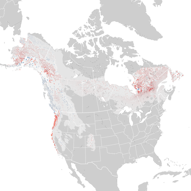

מגמות 2012-2022
עונת הקינון,28 יוני - 19 יולי
מפה זו מציגה את השינוי המצטבר בשפע היחסי המוערך מ2012 עד 2022 עם רדיוסים המייצגים אזורים של 27x27 ק״מ. אדום מצביע על ירידה וכחול מצביע על עלייה. ככל שהצבע כהה יותר, כך המגמה חזקה יותר. עיגולים לבנים מייצגים מיקומים בהם ערך המגמה לא מספיק שונה מאפס. גודל העיגולים נקבעים על ידי השפע היחסי המוערך באמצע תקופת הזמן.
מידע נוסףמגמת שפע
Pct. Change, 2012-2022
-30%-20-10לא וודאי+10+20+30
נמוך יותרהגבוה ביותר
מגמות אזוריות
טווח-מגמה רחבה (מרווח ביטחון)
80% רווח סמך, או טווח הערכים באזור בו המודל יחסית בטוח שהמגמה קיימת, ככל הנראה צמוד לערך האמצעי. מידע נוסף
-9.6% גבוה יותר
-17.9% אמצעי
-20.8% נמוך יותר
